Review - Ninox Robotics Perimeter 8+
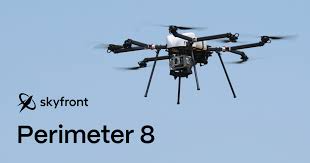
Australian drone specialist Ninox Robotics has teamed up with the NSW Rural Fire Service (RFS) to deploy the Perimeter 8+, a long-range fixed-wing UAV capable of over four hours in the air. It carries a dual thermal and optical gimbal camera, offering real-time high-resolution imagery—both visual and infrared—to spot emerging fire hotspots, particularly those ignited by lightning across remote western NSW. Significantly, they received authorization from the Civil Aviation Safety Authority to operate Beyond Visual Line of Sight (BVLOS) at night over an area equivalent to about one-eighth of NSW (roughly 1.15× the size of Texas). This extends aerial fire surveillance into hours when manned aircraft—and traditional fire-spotting methods—cannot fly.
Jon Wettack
8/8/20252 min read

🚁 What’s the Tech?
Australian drone specialist Ninox Robotics has teamed up with the NSW Rural Fire Service (RFS) to deploy the Perimeter 8+, a long-range fixed-wing UAV capable of over four hours in the air. It carries a dual thermal and optical gimbal camera, offering real-time high-resolution imagery—both visual and infrared—to spot emerging fire hotspots, particularly those ignited by lightning across remote western NSW.
Significantly, they received authorization from the Civil Aviation Safety Authority to operate Beyond Visual Line of Sight (BVLOS) at night over an area equivalent to about one-eighth of NSW (roughly 1.15× the size of Texas). This extends aerial fire surveillance into hours when manned aircraft—and traditional fire-spotting methods—cannot fly.
🛠️ How It Enhances Firefighting
Early Detection & Hotspot Mapping
Thermal sensors allow detection of nascent fire activity. By flying regular night missions, the system flags hotspots early—giving RFS teams a head start in directing crews and equipment (emberalerts.com).
All-Hours Coverage
Conventional aircraft ground at dusk, but drones don’t. Night flights reveal embers and smouldering areas otherwise invisible from the ground or by day (dronelife.com).
Operational Efficiency & Safety
Uncrewed systems reduce risk to aircrew and can navigate deep into smoke-filled areas teams wouldn’t otherwise fly. They deliver real-time maps and imagery to on-ground command units (firerescue.com.au, blog.nationalparks.nsw.gov.au).
Broader Adaptability
Drones aren’t just fire fighters — they’re multi-role. NSW already uses them in flood response, hazard reduction, infrastructure assessment, and post-fire recovery (airmedandrescue.com).
🔍 Putting It in Perspective
Strengths
Persistence & Reach: Over 4-hour flights and BVLOS capability translate into sustained, expansive coverage.
Versatile Data: Thermal + optical imaging supports rapid situational awareness.
Budget-Friendly: Much cheaper than helicopters and manned patrols — and no pilot risk.
Constraints
Weather Sensitivity: Drones can struggle in high heat, strong winds, or heavy smoke (dronelife.com, preventionweb.net).
Payload Capacity: These systems are for intel-gathering, not dropping retardants—active suppression via drones is still nascent (en.wikipedia.org).
Data Overload: Effective use demands strong data pipelines and skilled operators—more than just flying; you need analysts.
Cost & Infrastructure: Though cheaper than a chopper, drones need investment in control stations, maintenance, and skilled crews.
🌱 Future Outlook
The NSW trial fits into a global push—particularly in Canada, China, the U.S., and Europe—to integrate drones into wildfire strategies (theaustralian.com.au). Innovations like AI-powered swarm systems, payload drones for retardant, and tethered hover platforms are currently in development .
In the NSW context, combining drones for surveillance with ground units and aerial tankers promises a richer, safer, and more cost-effective response toolkit. With continued regulatory flexibility, investment in resilient hardware/software, and tighter lessons learned from field use, drones are poised to become core assets in bushfire defence.
Summary
The Ninox–RFS drone initiative represents a significant leap in aerial bushfire management for NSW. With long-endurance flight, night operations, and real-time thermal imaging, it enhances early warning, situational awareness, and strategic planning—all at lower cost and risk than manned aircraft. Still, robust data infrastructure, regulatory support, and further tech evolution are essential to unlock its full potential. As climate change intensifies fire seasons, these agile UAV systems could be transformative in how we detect, monitor, and ultimately fight wildfires.